AskBiography Logo   Latest News  Follow Us on Twitter  Follow Us on Google Buzz  Became Fan - Facebook  Subscribe to RSSRSS   Bookmark and Share

Map of Rensselaerswyck

Map of Rensselaerswyck
Document NameMap of Rensselaerswyck
Image Width500px
Image CaptionMap of Rensselaerswyck
Date Createdc. 1632
WriterUnknown
PurposeTo document the borders, topography, and locations within Rensselaerswyck

     Home | document | Map of Rensselaerswyck


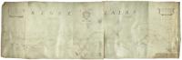
The Map of Rensselaerswyck is a map created during the 1630s, probably 1632, at the request of the owner of the Manor of Rensselaerswyck, Kiliaen van Rensselaer, Dutch jeweler and patroon. Rensselaerswyck was the only successful patroonship within the colony of New Netherland, settled by the Dutch West India Company at the behest of the States-General of the United Netherlands. The map is believed to be the first ever commissioned or created of Rensselaerswyck.

Map of Rensselaerswyck Video


Latest News : Map of Rensselaerswyck : Tweet this RSS

Want to Map of Rensselaerswyck latest news on your twitter account???   sign in with twitter
Map of Rensselaerswyck     sign in with twitter   ||  document     sign in with twitter   ||  Other     sign in with twitter


Privacy | Sitemap | Micra Hosting | USA Yellow Pages