AskBiography Logo   Latest News  Follow Us on Twitter  Follow Us on Google Buzz  Became Fan - Facebook  Subscribe to RSSRSS   Bookmark and Share

Shropshire

Shropshire
NameShropshire
Motto
Floreat Salopia
StatusCeremonial county & (smaller) Unitary district
OriginHistoric
RegionWest Midlands
ArearankRanked 13th
Area Km23487
AdminarearankRanked  
Adminarea Km2 
AdminhqShrewsbury
IsoGB-SHR
Ons00GG
Nuts3UKG22
PoprankRanked  
Popestdate 
Pop 
Density Km2 
AdminpoprankRanked  
Adminpop 
Ethnicity97.3% White
1.2% S.Asian
CouncilNo county council

Shropshire Council
http://www.shropshire.gov.uk
_______

Telford and Wrekin Council
http://www.telford.gov.uk
Mps{{Collapsible list
Title5
Frame Styleborder:none; padding: 0;
List Styletext-align:left;display:none;
1Mark Pritchard (C)
2Philip Dunne (C)
3Daniel Kawczynski (C)
4Owen Paterson (C)
5David Wright (L) }}
Subdivs# Shropshire Council (unitary) # Telford and Wrekin (unitary)

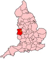
     Home | England county unitary | Shropshire


Shropshire (c-eniconˈʃrɒpʃər or c-enˈʃrɒpʃɪər; alternatively Salop; abbreviated, in print only, Shrops) is a county in the West Midlands region of England. For Eurostat purposes, the county (less the unitary district of Telford and Wrekin) is a NUTS 3 region (code UKG22) and is one of four counties or unitary districts that comprise the "Shropshire and Staffordshire" NUTS 2 region. It borders Wales to the west. Shropshire is one of England's most rural and sparsely populated counties with a population density of 91/km2 (337/sq mi). The shire county and its districts were replaced by a unitary authority on 1 April 2009. The borough of Telford and Wrekin, included in Shropshire for ceremonial purposes, has been a unitary authority since 1998.

The county is centred on six main towns starting with the county town of Shrewsbury, which is culturally and historically important, although Telford, which was constructed around a number of older towns, most notably Wellington, Dawley and Madeley, is today the most populous. The other main towns are Oswestry in the north-west, Newport to the east, Bridgnorth in the south-east, and Ludlow to the south. Whitchurch and Market Drayton in the north of the county are also of notable size.

The Ironbridge Gorge area is a UNESCO World Heritage Site, covering Ironbridge, Coalbrookdale and a part of Madeley. There are, additionally, other notable historic industrial sites located around the county, such as Broseley, Snailbeach and Highley as well as the Shropshire Union Canal.

The Shropshire Hills Area of Outstanding Natural Beauty covers about a quarter of the county, mainly in the south. The Wrekin is one of the most famous natural landmarks in the county, though the highest hills are the Clee Hills, Stiperstones and the Long Mynd. Wenlock Edge is another significant geographical and geological landmark. In the low-lying northwest of the county (and overlapping the border with Wales) is the Fenn's, Whixall and Bettisfield Mosses National Nature Reserve, one of the most important and best preserved bogs in Britain. The River Severn, Great Britain's longest river, runs through the county, exiting into Worcestershire via the Severn Valley. Shropshire is landlocked, and with an area of 3197 km2 (1234.4 sqmi), is England's largest inland county.

The County flower is the round-leaved sundew.


Warning: simplexml_load_file(http://gdata.youtube.com/feeds/api/videos/-/Shropshire?orderby=viewCount&max-results=10) [function.simplexml-load-file]: failed to open stream: HTTP request failed! HTTP/1.0 410 Gone in /home/askbio/public_html/index_bio.php on line 257

Warning: simplexml_load_file() [function.simplexml-load-file]: I/O warning : failed to load external entity "http://gdata.youtube.com/feeds/api/videos/-/Shropshire?orderby=viewCount&max-results=10" in /home/askbio/public_html/index_bio.php on line 257

Fatal error: Call to a member function children() on a non-object in /home/askbio/public_html/index_bio.php on line 260