 RSS
RSS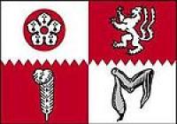
Home | England county | Leicestershire
|
|
|
Leicestershire (c-enaudio=En-leicestershire is a landlocked county in the English Midlands. It takes its name from the heavily populated City of Leicester, traditionally its administrative centre, although the City of Leicester unitary authority is today administered separately from the rest of Leicestershire. The county borders Derbyshire to the north-west, Nottinghamshire to the north, Rutland to the east, Warwickshire to the south-west, Staffordshire to the west, Lincolnshire to the north-east, and Northamptonshire to the south-east. The border with Warwickshire is Watling Street (the A5). County Hall, situated in Glenfield, about 3 miles (5 km) north-west of Leicester city centre, is the seat of Leicestershire County Council and the headquarters of the county authority. The City of Leicester is administered from offices in Leicester itself and the City Council meets at Leicester Town Hall. The River Soar rises to the east of Hinckley, in the far south of the county, and flows northward through Leicester before emptying into the River Trent at the point where Derbyshire, Leicestershire, and Nottinghamshire meet. A large part of the north-west of the county, around Coalville, forms part of the new National Forest area extending into Derbyshire and Staffordshire. The highest point of the county is Bardon Hill at 278 metres (912 ft), which is also a Marilyn. As part of a 2002 marketing campaign, the plant conservation charity Plantlife chose the Foxglove as the county flower. |