East Frisian Islands : Ask Biography
AskBiography Logo   Latest News  Follow Us on Twitter  Follow Us on Google Buzz  Became Fan - Facebook  Subscribe to RSSRSS   Bookmark and Share

East Frisian Islands

East Frisian Islands
Islands information
NameEast Frisian Islands
Native nameOstfriesische Inseln
LocationWadden Sea
Total islands12
Major islandsBorkum, Norderney
Administration information
Germany
StateLower Saxony
DistrictsLeer
Aurich
Wittmund
Friesland
Administration information
Ethnic groupsGermans, Frisians

     Home | Islands | East Frisian Islands


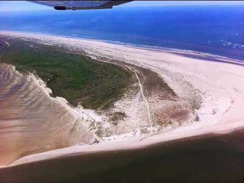
The East Frisian Islands (German: Ostfriesische Inseln) are a chain of islands in the North Sea, off the coast of East Frisia in Lower Saxony, Germany. The islands extend for some 90 km (55.9 mi) from west to east between the mouths of the Ems and Jade / Weser rivers and lie about 3.5 to 10 km offshore. Between the islands and the mainland are extensive mudflats, known locally as Watten, which form part of the Wadden Sea. In front of the islands are Germany's territorial waters, which occupy a much larger area than the islands themselves. The islands, the surrounding mudflats and the territorial waters (The Küstenmeer vor den ostfriesischen Inseln nature reserve) form a close ecological relationship. The island group makes up about 5% of the Lower Saxony Wadden Sea National Park.

The largest island by surface area is Borkum, located at the western end of the chain; the other six inhabited islands are from west to east: Juist, Norderney with the largest town in the islands, Baltrum Langeoog, Spiekeroog and Wangerooge. There are also four other small, uninhabited islands: Lütje Hörn east of Borkum, Memmert and Kachelotplate southwest of Juist, Minsener Oog, a dredged island southeast of Wangerooge, and Mellum at the eastern end of the island chain which, following the boundary revision by the Federal Office for Nature Conservation, no longer belongs to the East Frisian Islands, but to the mudflats of the Elbe-Weser Triangle (Watten im Elbe-Weser-Dreieck).

East Frisian Islands Video


3.93 min. | 0 user rating
Baltrum ist eine Düneninsel vor der Küste von Ostfriesland in Niedersachsen. Sie liegt in der Mitte der Kette der sieben bewohnten Ostfriesischen Inseln und ist sowohl nach Fläche als auch...
17.48 min. | 5.0 user rating
Rundflug Ostfriesische Inseln Norderney-Baltrum-Juist Cessna 172 Juli 2013.
9.75 min. | 5.0 user rating
Silvester 2013 auf der Nordseeinsel Borkum, mit Impressionen vom Borkumer Silvesterlauf, Olljahrs-Singen, Silvesterfeuerwerk und Neujahrsbaden 2014. Mein Filmbeitrag richtet sich an alle Insulaner.
17.02 min. | 5.0 user rating
Learn more at http://www.skidata.com The island of Juist focuses intensely on its guests and works very closely with its partner AG Reederei Norden-Frisia. SKIDATA implemented its destination...
3.28 min. | 5.0 user rating
In 2009, UNESCO placed the mudflats of Germany's North Sea coast, and the adjacent Dutch Wadden Sea Conservation Area on its World Heritage list. This unique eco-system fascinates millions...
4.55 min. | 5.0 user rating
http://www.morschenich.info Vereinsausflug mit unseren UL-Flugzeugen zur Nordseeinsel Baltrum. Start am Ultralight-Flugplatz Morschenich, zwischen Köln und Aachen gelegen. Wir waren u.a. mit...
2.45 min. | 5.0 user rating
SIM720 - East Frisian Island Airports Five places to fly for peace, quiet and plenty of bracing North Sea air. http://flight.sim720.co.uk/
1.17 min. | 4.0 user rating
Ostfriesische Inseln aus der Luft Urlaub auf Norderney im Juli 2013.
7.95 min. | 5.0 user rating
Borkum ist die westlichste und mit knapp 31 Quadratkilometer die größte der sieben bewohnten Ostfriesischen Inseln. Teile der Insel und das angrenzende Watt gehören zum Nationalpark Niedersächs...
8.10 min. | 3.66 user rating

Latest News : East Frisian Islands : Tweet this RSS

Want to East Frisian Islands latest news on your twitter account???   sign in with twitter
East Frisian Islands     sign in with twitter   ||  Islands     sign in with twitter   ||  Travel     sign in with twitter

Coat of arms Island/Sand flat Municipality District Area
in km2 (2004/05)
Distance to the mainland
in km (2004)
Population
as at: 31 December 2008
Population density
per km2
Borkum Town of Borkum Leer 30.74 10.5 5,186 169
  Kachelotplate not municipalised no data uninhabited −
  Lütje Hörn Island of Lütje Hörn¹ Leer 0.1 12.5 uninhabited −
  Memmert North Sea island of Memmert¹ Aurich 4.3 13 uninhabited −
Juist Juist Aurich 16,43 8 1,696 103
Norderney Town of Norderney Aurich 26.29 3 5,810 221
Baltrum Baltrum Aurich 6,5 4.5 488 75
Langeoog Langeoog Wittmund 19.67 5 1,953 99
Spiekeroog Spiekeroog Wittmund 18.25 6.5 781 43
Wangerooge Wangerooge Friesland 7.94 6,5 923 116
  Minsener Oog
artificially dredged
Butjadingen2 Wesermarsch 2.2 3.5 uninhabited −
  Mellum³ Butjadingen2 Wesermarsch 4.9 6 uninhabited −
East Frisian Islands 134.35 − 16,837 129
¹ unparished area
2 former parish of Langwarden, which was incorporated in 1974 into Butjadingen (today the Gemarkung of Langwarden)
³ east of the outer Jade, after the boundary revision by the Federal Agency for Nature Conservation no longer part of the East Frisian Islands, but belongs to the mudflats in the Elbe-Weser Triangle Watten im Elbe-Weser-Dreieck.

Frisian Islands

West Frisian IslandsNoorderhaaks * Texel * Vlieland * Richel * Terschelling * Griend * Ameland * Rif * Engelsmanplaat * Schiermonnikoog * Simonszand * Rottumerplaat * Rottumeroog * Zuiderduintjes
East Frisian IslandsBorkum * Lütje Hörn * Kachelotplate * Memmert * Juist * Norderney * Baltrum * Langeoog * Spiekeroog * Wangerooge * Minsener-Oldoog * Mellum
between East Frisian and North Frisian IslandsLanglütjen I & II * Hoher Knechtsand * Heligoland * Neuwerk * Scharhörn * Nigehörn * Trischen * Tertius * Blauort
North Frisian Islands (Germany)Pellworm * the Halligen * Amrum * Föhr * Sylt * Uthörn
Danish Wadden Sea IslandsJordsand * Rømø * Koresand * Mandø * Fanø * Langli


Privacy | Sitemap | Micra Hosting